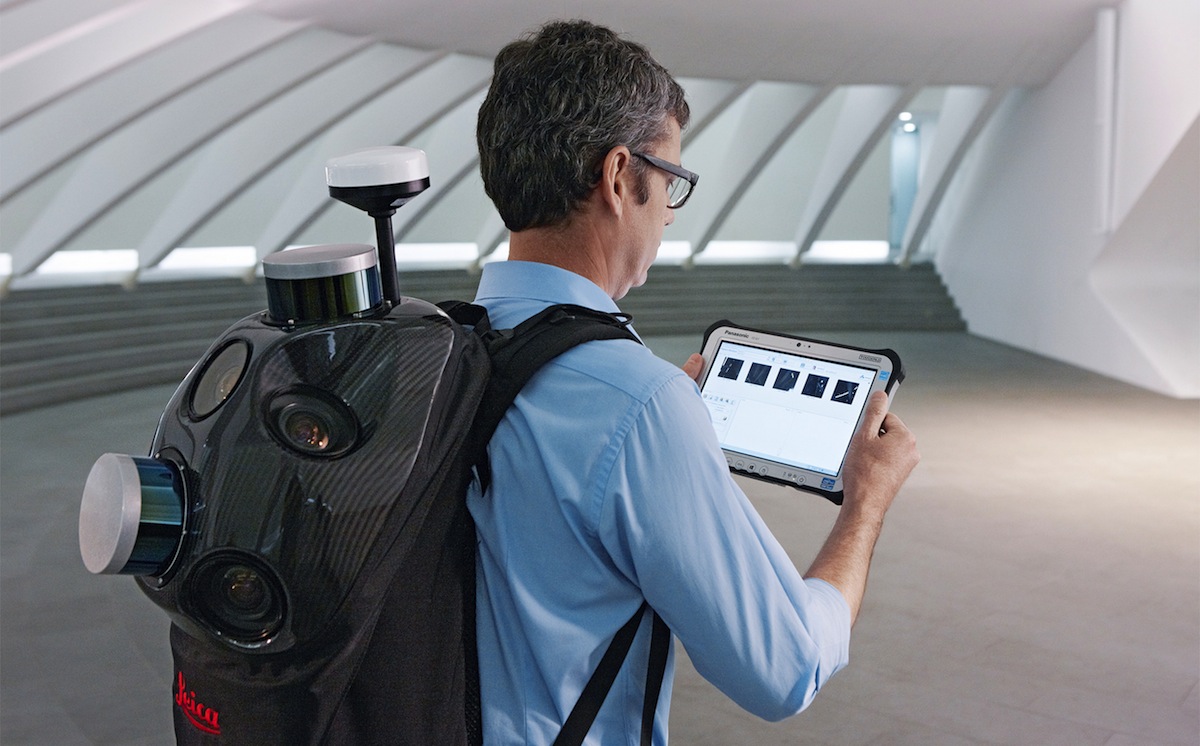
Leica Geosystems announced the industry’s first commercially available wearable reality-capture technology with the Pegasus:Backpack at HxGN LIVE.
Combining five high-dynamic cameras, which work in a variety of light conditions, and a LiDAR profiler with an ultra-light and ergonomic carbon fiber chassis, this mobile mapping solution creates a 3D view indoors or outdoors for engineering or professional documentation creation at the highest level of authority yet.
For BIM or simply for capturing 2D square foot updates to a large building, the Leica Pegasus:Backpack creates the most realistic view by capturing synchronized imagery and point cloud data. Accurate positioning is achieved in GNSS-restricted areas using Simultaneous Localization and Mapping, or SLAM, technology. Together with a high precision inertial measurement unit, the Leica Pegasus:Backpack is the first position-agnostic solution.
This new technology is designed to enable weekly data capture efficiently and cost effectively for changing building construction sites. For the first time, this enables the creation of a full starting document for authoritative 6D management of a building or simply to provide an authoritative hand-off dataset to a new building owner. By capturing weekly during a building’s construction, an “x-ray” view of the building is created. As the Backpack clearly logs position and time with the advanced measurement of LiDAR, change orders in the construction process can now offer a complete new level of authority for quality construction while scheduled milestones are achieved.
With full 360-spherical views and LiDAR together plus a hardware light sensor, all images are usable while other functions are verifiable and adjustable over the operator’s tablet device. The system uses multiple hot-swappable batteries, making even long captures possible.
“With the Leica Pegasus:Backpack, limited-access outdoor areas or underground infrastructures are no longer limited in professional data collection,” said Stuart Woods, Geospatial Solutions Division vice-president. “Users will never again forget any aspect of any job nor need to return to a project site. They can capture everything by simply arriving on site wearing the technology, capture and leave, rest assured they have everything they need to complete the job on time and on budget.”
Working with images and point clouds together, data is captured into a single platform and workflow – from the operator interface to a single-click post-processing to feature Meta tagging. Leveraging Leica’s Mapfactory extension, features can be extracted and datasets can be exported to CAD or BIM specific software solutions. More effective decision making is finally achieved with 3D spatial models that allow for true life cycle building planning, enabling 6D BIM.
Related Stories
BIM and Information Technology | Mar 2, 2016
Thanks to MIT researchers, Boston now has its very own citywide building energy model
The most detailed model ever for a city this size will help Boston meet its long-term energy use goals.
BIM and Information Technology | Feb 24, 2016
5 tips for creating photorealistic architectural renderings
Storytelling, authenticity, and detail are vital to producing lifelike project artwork, according to a digital art specialist.
Augmented Reality | Feb 17, 2016
Startup Meta unveils holographic augmented reality prototype
The startup is an underdog in the AR battle but has a range of investors and fans.
Game Changers | Feb 5, 2016
London’s ’shadowless’ towers
Using advanced design computation, a design team demonstrates how to ‘erase’ a building’s shadows.
Game Changers | Feb 4, 2016
GAME CHANGERS: 6 projects that rewrite the rules of commercial design and construction
BD+C’s inaugural Game Changers report highlights today’s pacesetting projects, from a prefab high-rise in China to a breakthrough research lab in the Midwest.
Drones | Feb 3, 2016
A new volume measurement tool makes drone imagery easier to analyze
DroneDeploy’s latest app is available for all mobile devices.
BIM and Information Technology | Jan 27, 2016
Seeing double: Dassault Systèmes creating Virtual Singapore that mirrors the real world
The virtual city will be used to help predict the outcomes of and possible issues with various scenarios.
BIM and Information Technology | Jan 26, 2016
How the Fourth Industrial Revolution will alter the globe’s workforce
The next great technological metamorphosis will be unlike anything humankind has experienced before, due to the sheer size, speed, and scope of disruption.
Great Solutions | Jan 20, 2016
Skanska’s new app helps construction teams monitor and meet environmental quality standards while renovating hospitals
App allows users to track noise, differential pressure levels, vibration, and dust
Augmented Reality | Jan 19, 2016
Will Generation Virtuals' office be a pair of glasses?
A waning need for office buildings may be on the horizon, thanks to the possibility of working remotely via new technologies like Google Cardboard, writes HDR's Rachel Park.


