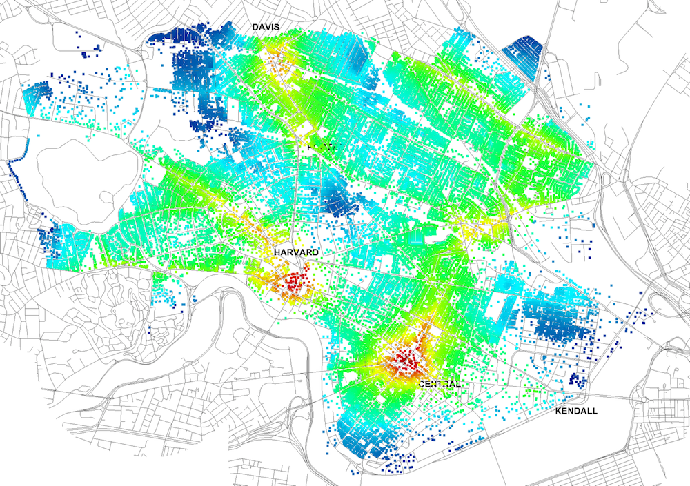
Four years ago, Massachusetts Institute of Technology’s City Form Lab launched Urban Network Analysis (UNA), a city-modeling software that facilitates a mathematical analysis of relationships among elements in a complex system, like a city. The unique feature of UNA is that it incorporates activities within buildings into its analysis.
This toolbox has been popular with planners and geographers, but it requires ArcGIS10 software with an ArcGIS Network Analysis Extension.
In April, City Form Lab expanded this software’s utility by introducing UNA for Rhino 3D, a modeling software for architects, engineers, and designers.
“Our toolbox helps planners and architects analyze these relationships and quantify how intensely different routes are likely to be utilized, how visible or connected public spaces are, or how conveniently one can get from one space to another,” says Andres Sevtsuk, the principal investigator at City Form Lab and developer of the UNA tool.
In layman’s terms, the software predicts where people are likely to go once they’ve decided upon an activity, like, say, going to an ATM machine or a park. The software provides users with some idea about which ATM or park that would be. As for movements to and within buildings, UNA takes into account employee head count, a building’s value, the surrounding population, and so forth.
This app’s toolbox also computes how urban design can affect—or even dictate—pedestrian movement. Sevtsuk notes, too, that the software can be scaled to account for the diversity of movement in different cities and towns.
Sevtsuk is encouraged by the sheer amount of spatial data available about urban areas, particularly in the U.S., where “you can go to any sizable city website and download data that is necessary to calibrate any of these models.” He’s confident that this software can be used to predict movement in public or semi-public spaces such as building lobbies or shopping centers.
Related Stories
| Oct 4, 2012
Electronic power tool builds project transparency
As building projects have grown in scope and complexity, so, too, has the task of document management. A new online tool is helping Building Teams meet that demand.
| Aug 8, 2012
BIM’s future up in the cloud
The AEC industry is on the cusp of a still more significant evolution with cloud computing.
| Jul 9, 2012
Integrated Design Group completes UCSB data center
Firm uses European standard of power at USCB North Hall Research Data Center.
| Jul 3, 2012
Trimble to acquire WinEstimator
Acquisition adds estimating software solutions to Meridian Systems’ portfolio.
| Jun 1, 2012
New BD+C University Course on Insulated Metal Panels available
By completing this course, you earn 1.0 HSW/SD AIA Learning Units.
| Jun 1, 2012
Caruso to lead Gensler’s Asia talent development
Caruso will be based in Shanghai and working with the Gensler offices in Japan, China, South Korea, Singapore, Thailand, and India until the spring of 2013.
| Jun 1, 2012
New York City Department of Buildings approves 3D BIM site safety plans
3D BIM site safety plans enable building inspectors to take virtual tours of construction projects and review them in real-time on site.
| May 31, 2012
8 steps to a successful BIM marketing program
It's not enough to have BIM capability--you have to know how to sell your BIM expertise to clients and prospects.
| May 29, 2012
Reconstruction Awards Entry Information
Download a PDF of the Entry Information at the bottom of this page.


