Later this month, construction is scheduled to begin on the country’s first business park specifically for unmanned aircraft.
The Associated Press reports that the first order of business for Grand Sky Development Corp., the park’s manager, will be building an eight-foot-high security chain link fence, with barbed wire at the top, to surround 200 acres adjacent to the Grand Forks Air Force Base in North Dakota.
Last week, the 1.2-million-sf Grand Sky aerospace technology park—one of six sites designated by the Federal Aviation Administration for drone testing—was awarded $5.6 million from the state. North Dakota has already invested more than $30 million at this park, which recently added Northrup Grumman as its second anchor tenant, along with General Atomics. North Dakota’s legislature has appropriated $4.4 million for Grand Sky’s future development.
The contract for constructing the fence, which had been planned since 2011, was awarded to Grand Forks-based iconHD, whose parent company is ICON Architectural Group.
Thomas Swoyer, Jr., Grand Sky Development’s president, says the fence is “symbolic,” in that it will “define the park space and give us the ability to control our own access to it.”
General Atomics has signed a tentative agreement to establish an unmanned aerial systems training academy at the park.
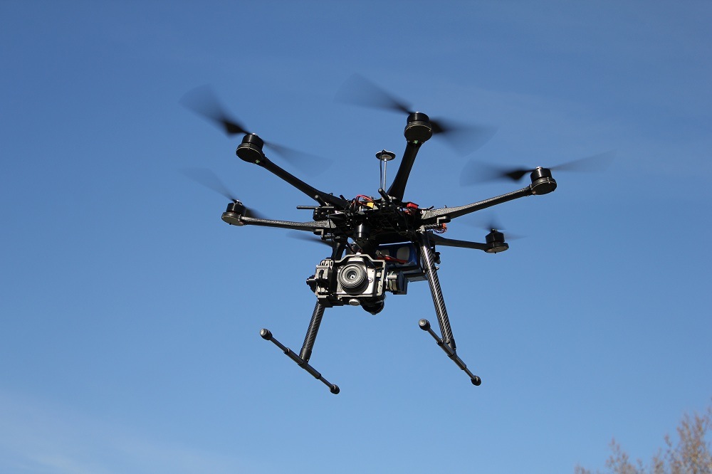
In the summer of 2014, FAA announced the selection of the six public entities that would develop unmanned aircraft systems (UAS) research at test sites around the country. One of these is the North Dakota Department of Commerce, which was issued a Certificate of Waiver or Authorization (COA) to begin using a Draganflyer X4ES small UAS at its Northern Plains Unmanned Aircraft Systems Test Site.
Other drone test-site operators include:
• The University of Alaska, which was issued a COA that authorized flights by an Aeryon Scout small UAS for animal surveys at the university’s Pan-Pacific UAS Test Range Complex in Fairbanks. That authorization encompasses test ranges in Hawaii, Oregon, Kansas, and Tennessee.
• The State of Nevada, which was authorized to test an onsite ScanEagle drone at the Desert Rock Airport located in Mercury, Nev. Desert Rock Airport is a private airport owned and operated by the Department of Energy. The ScanEagle flies at or below 3,000 feet.
• Texas A&M University–Corpus Christi plans to develop safety requirement for UAS vehicles. It is authorized to use an AAAI RS-16 UAS, which weights about 85 pounds and has a wingspan of almost 13 feet.
• Griffiss International Airport is authorized to test at a site in Rome, N.Y. One drone is a PrecisionHawk Lancaster Platform UAS that weighs about three pounds and has a wingspan of four feet. Texas-based HoverStat, which develops technology to use small drones for measuring roofs for solar panel installation, reportedly decided to choose Syracuse as a testing location because the Rome site was nearby.
• Virginia Polytechnic Institute is conducting failure mode testing with a Smart Road Flyer, a low cost, low risk multi-rotor UAS being developed to support research in vehicle and highway systems. Other UAS models being tested include an eSPAARO, Aeryon Sky Ranger, MANTRA2, Sig Rascal, and two AVID EDF-8 micro UASs.
At this site, the Mid-Atlantic Aviation Partnership—a part of Greene’s Institute—has spearheaded drone research. The Virginia Tech site is partnered with the University of Maryland and Rutgers University in New Jersey.
Last month, the Federal Aviation Administration waived the authorization process for the agency’s six nationwide drone test sites that had required clearance before moving forward with research exercises at or below 200 feet.
Related Stories
BIM and Information Technology | Aug 27, 2015
Zebra Imaging launches 3D hologram creator for Autodesk Revit
Company promises new product will bring "easy creation process" to holographic imaging in AEC community.
Office Buildings | Aug 24, 2015
British company OpenDesk offers open-sourced office furniture
Offices can “download” their furniture to be made locally, anywhere.
Energy Efficiency | Aug 24, 2015
Google develops Google Maps for solar energy
The tool offers high-resolution aerial maps, like the one used in Google Earth, to estimate the total sunlight a rooftop receives throughout the year.
Sponsored | BIM and Information Technology | Aug 20, 2015
Part II - Will BIM Work as a Deliverable? A Legal Perspective on BIM
Having the right counsel on your team can be the difference between long drawn-out negotiations and breaking new ground to meet the owner’s needs.
BIM and Information Technology | Aug 17, 2015
Reimagined cursors can change digital imaging
A University of Montreal professor has developed a system that elevates 2D cursors for a 3D world.
BIM and Information Technology | Aug 6, 2015
After refueling its capital tank, WeWork acquires BIM consultant Case
The merger is expected to help standardize how WeWork designs and builds out office space.
Giants 400 | Aug 6, 2015
BIM GIANTS: Robotic reality capture, gaming systems, virtual reality—AEC Giants continue tech frenzy
Given their size, AEC Giants possess the resources and scale to research and test the bevy of software and hardware solutions on the market. Some have created internal innovation labs and fabrication shops to tinker with emerging technologies and create custom software tools. Others have formed R&D teams to test tech tools on the job site.
Smart Buildings | Aug 5, 2015
8 cities win Bloomberg's 'open data' award
The competition, called "What Works Cities," promotes innovation in city government by making the massive amounts of city operations data more publicly accessible to better improve issues like job creation, public health, and blight.
Multifamily Housing | Aug 5, 2015
FacadeRetrofit.org: A new database for tracking commercial and multifamily façade upgrades
The site allows users to submit information about new projects, or supplement information on those already posted.
BIM and Information Technology | Aug 4, 2015
Augmented reality app provides step-by-step help for repairing equipment
The developers of Remote AR have discovered a new application for AR technology that could apply to all types of industries, including commercial buildings.


