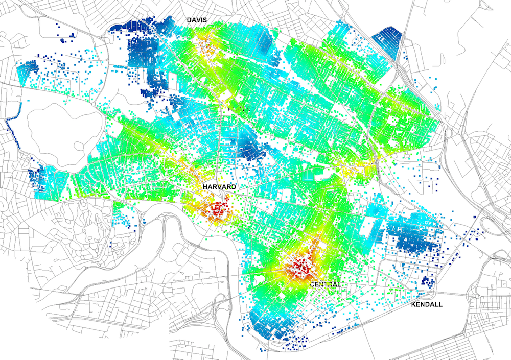
Four years ago, Massachusetts Institute of Technology’s City Form Lab launched Urban Network Analysis (UNA), a city-modeling software that facilitates a mathematical analysis of relationships among elements in a complex system, like a city. The unique feature of UNA is that it incorporates activities within buildings into its analysis.
This toolbox has been popular with planners and geographers, but it requires ArcGIS10 software with an ArcGIS Network Analysis Extension.
In April, City Form Lab expanded this software’s utility by introducing UNA for Rhino 3D, a modeling software for architects, engineers, and designers.
“Our toolbox helps planners and architects analyze these relationships and quantify how intensely different routes are likely to be utilized, how visible or connected public spaces are, or how conveniently one can get from one space to another,” says Andres Sevtsuk, the principal investigator at City Form Lab and developer of the UNA tool.
In layman’s terms, the software predicts where people are likely to go once they’ve decided upon an activity, like, say, going to an ATM machine or a park. The software provides users with some idea about which ATM or park that would be. As for movements to and within buildings, UNA takes into account employee head count, a building’s value, the surrounding population, and so forth.
This app’s toolbox also computes how urban design can affect—or even dictate—pedestrian movement. Sevtsuk notes, too, that the software can be scaled to account for the diversity of movement in different cities and towns.
Sevtsuk is encouraged by the sheer amount of spatial data available about urban areas, particularly in the U.S., where “you can go to any sizable city website and download data that is necessary to calibrate any of these models.” He’s confident that this software can be used to predict movement in public or semi-public spaces such as building lobbies or shopping centers.
Related Stories
| Aug 11, 2010
BIM adoption tops 80% among the nation's largest AEC firms, according to BD+C's Giants 300 survey
The nation's largest architecture, engineering, and construction companies are on the BIM bandwagon in a big way, according to Building Design+Construction's premier Top 50 BIM Adopters ranking, published as part of the 2009 Giants 300 survey. Of the 320 AEC firms that participated in Giants survey, 83% report having at least one BIM seat license in house, half have more than 30 seats, and near...
| Aug 11, 2010
Thrown For a Loop in China
While the Bird's Nest and Water Cube captured all the TV coverage during the Beijing Olympics in August, the Rem Koolhaas-designed CCTV Headquarters in Beijing—known as the “Drunken Towers” or “Big Shorts,” for its unusual shape—is certain to steal the show when it opens next year.
| Aug 11, 2010
Great Solutions: BIM/Information Technology
4. Architectural Visualization through Gaming Technology Before 3D walkthroughs for client presentations were popular, HKS manager of Advanced Technologies Pat Carmichael and his team were working to marry gaming engines with 3D building models. "What's being tasked to us more and more is not just to show design, but to show function," Carmichael said.
| Aug 11, 2010
Great Solutions: Collaboration
9. HOK Takes Videoconferencing to A New Level with its Advanced Collaboration Rooms To help foster collaboration among its 2,212 employees while cutting travel time, expenses, and carbon emissions traveling between its 24 office locations, HOK is fitting out its major offices with prototype videoconferencing rooms that are like no other in the U.
| Aug 11, 2010
BIM school, green school: California's newest high-performance school
Nestled deep in the Napa Valley, the city of American Canyon is one of a number of new communities in Northern California that have experienced tremendous growth in the last five years. Located 42 miles northeast of San Francisco, American Canyon had a population of just over 9,000 in 2000; by 2008, that figure stood at 15,276, with 28% of the population under age 18.


