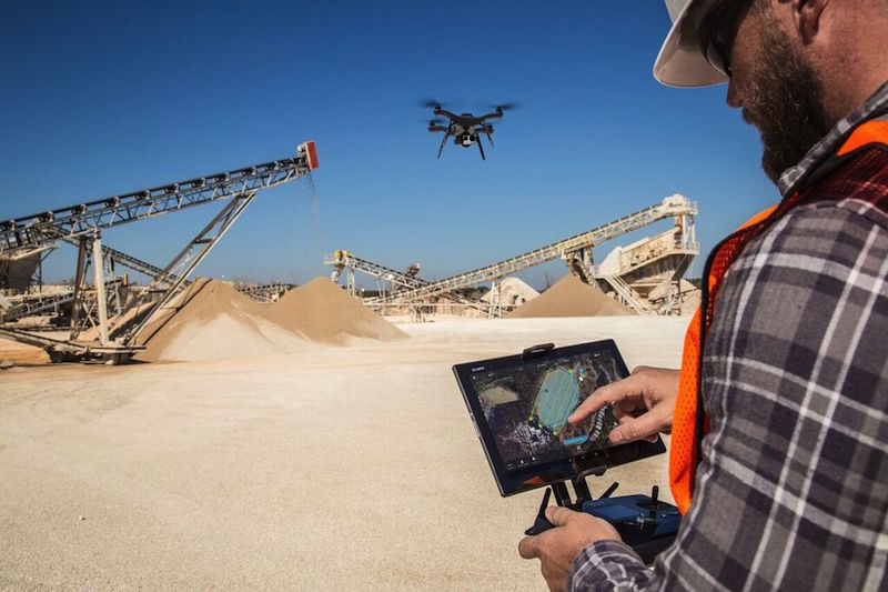
Drone maker 3DRobotics (3DR) has teamed with Autodesk and Sony to launch Site Scan, an aerial analytics platform for use by field professionals to inspect, survey, and scan jobsites and land masses, and deliver image-capture data via the cloud for quicker processing and 3D modeling.
Keith Bigelow, a VP at 3DR’s Enterprise division, tells BD+C that for the past year his company has worked with the reality-capture team at Autodesk to understand how a product like Site Scan would need to perform in order produce high-resolution images that could be processed by modeling tools “that AEC customers are using every day.”
The resulting package includes a Solo drone that can be programmed to fly over a designated area without pilot assistance; a Sony Xperia Z4 tablet with a pre-installed Site Scan software; a Sony UMC-R10C or GoPro Hero4 Black camera equipped with lenses for inspection and 2D and 3D mapping; unlimited storage in 3DR’s cloud; and unlimited processing and publishing credits with Autodesk’s cloud, known as FORGE.
The drone’s flight time is about 20 minutes per battery, and is best suited for inspecting and scanning sites that are between two and 160 acres, says Bigelow.
A tablet with the Site Scan app can be used to manage the flight and image collection. (The tablet also runs Google Earth, which is used to program the drone’s flight path.)
Site Scan’s Survey mode captures and creates high-resolution maps and digital elevation models, while its Scan mode captures and creates 3D models. These reality data—such as 3D point cloud, 2D orthographic views, and 3D mesh—can be integrated into popular professional design and engineering platforms, including many of Autodesk’s products.
3DR is an early adopter of the FORGE platform, leveraging the ReCap Photo Web API. “Capture technology is rapidly transforming the way people collect information and make insightful decisions in the field,” says Amar Hanspal, SVP of Products at Autodesk.
The Site Scan package, which includes four batteries and a charger, will be available in June for $4,999, plus a monthly service fee of $499 that covers the drone and tablet license, cloud access, and technical support.
Bigelow says AEC firms are Site Scan’s primary targets, and he foresees this platform being helpful to inform design and construction decisions for a host of different building projects.
He also points out Site Scan will be available around the time that the Federal Aviation Administration issues its new rules for commercial drone use, which are expected to allow a person to fly a drone without a pilot’s license as long as he or she is certified by passing a written test that demonstrates familiarity with FAA’s UAV education booklet.
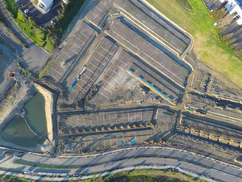 A high-resolution image of a construction site, captured by a camera-equipped drone that is part of the Site Scan platform. Image: 3DRobotics
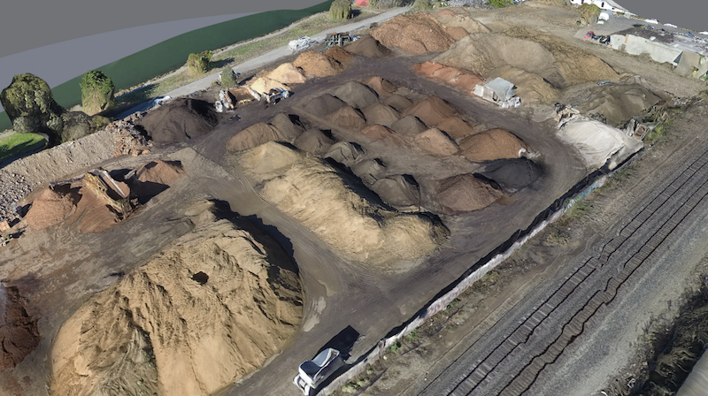 A 3D model of a land site created from point-cloud data processed through Site Scan's software. Image: 3DRobotics
Related Stories
BIM and Information Technology | May 8, 2023
3 ways computational tools empower better decision-making
NBBJ explores three opportunities for the use of computational tools in urban planning projects.
Sustainability | May 1, 2023
Increased focus on sustainability is good for business and attracting employees
A recent study, 2023 State of Design & Make by software developer Autodesk, contains some interesting takeaways for the design and construction industry. Respondents to a survey of industry leaders from the architecture, engineering, construction, product design, manufacturing, and entertainment spheres strongly support the idea that improving their organization’s sustainability practices is good for business.
Sustainability | Apr 20, 2023
13 trends, technologies, and strategies to expect in 2023
Biophilic design, microgrids, and decarbonization—these are three of the trends, technologies, and strategies IMEG’s market and service leaders believe are poised to have a growing impact on the built environment.
Urban Planning | Apr 17, 2023
The future of the 20-minute city
Gensler's Stacey Olson breaks down the pros and cons of the "20-minute city," from equity concerns to data-driven design.
Intelligent Lighting | Feb 13, 2023
Exploring intelligent lighting usage in healthcare, commercial facilities
SSR's Todd Herrmann, PE, LEEP AP, explains intelligent lighting's potential use cases in healthcare facilities and more.
AEC Tech | Jan 27, 2023
Epic Games' latest foray into the AEC market and real estate industry
From architecture to real estate, the realm of computer-aided design hits new heights as more and more firms utilize the power of Epic Games’ Twinmotion and Unreal Engine.
AEC Tech | Jan 27, 2023
Key takeaways from Autodesk University 2022
Autodesk laid out its long-term vision to drive digital collaboration through cloud-based solutions and emphasized the importance of connecting people, processes and data.
Digital Twin | Nov 21, 2022
An inside look at the airport industry's plan to develop a digital twin guidebook
Zoë Fisher, AIA explores how design strategies are changing the way we deliver and design projects in the post-pandemic world.
BAS and Security | Oct 19, 2022
The biggest cybersecurity threats in commercial real estate, and how to mitigate them
Coleman Wolf, Senior Security Systems Consultant with global engineering firm ESD, outlines the top-three cybersecurity threats to commercial and institutional building owners and property managers, and offers advice on how to deter and defend against hackers.
Sponsored | BIM and Information Technology | Jul 19, 2022
Why Autodesk Tandem is the best fit for your projects


