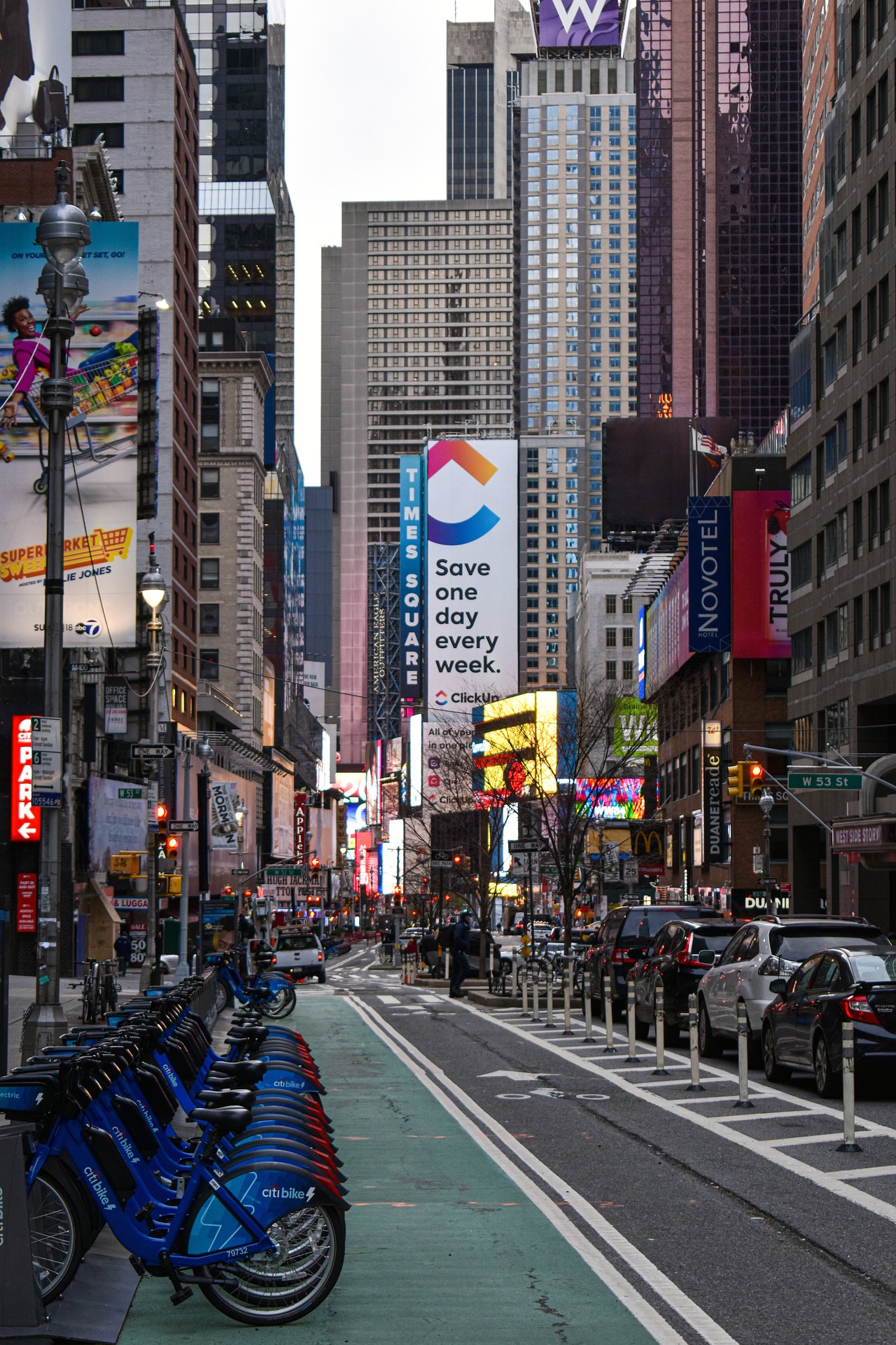
In 2023, New York City recorded its safest year for pedestrians since record-keeping began in 1910. In a city of 8.5 million people, 101 deaths were due to vehicles striking pedestrians, less than one-third the number of the early 1990s.
New York City ramped up its efforts to make walking and biking safer in 2014 when the city reduced its speed limit to 25 miles per hour. It also launched a speed camera enforcement program and started campaigns to educate drivers and pedestrians.
In recent years, the city has redesigned dangerous intersections—1,500 such projects last year alone—using various strategies. These include:
- Implemented leading pedestrian intervals (LPIs) that lengthen red light intervals for a few seconds so pedestrians can get a head start
- Constructed raised crosswalks that slow cars and improve visibility
- Created more daylighting that removes parked cars near crosswalks to improve visibility
- Installed turn bumps, strips of high-visibility black-and-yellow plastic that prompt drivers to wait to turn instead of jutting out in front of pedestrians crossing the street
Smaller-scale safety fixes such as these don’t require outreach to local community boards or comprehensive studies. Other measures such as adding bike lanes or bus-only lanes that remove parking spaces are more contentious.
The city has more to do to make streets safer, though. Total traffic fatalities remain high, with drivers dying in crashes at greater rates than in past years. Experts attribute higher traffic fatalities to a spike in dangerous speeding and bigger vehicles.
In addition, fatal crashes involving cyclists are at a 23-year high. The rising number of electric bikes has been cited as a factor in cycle accidents mostly in vehicle collisions on roadways that lack bike lanes. The city has extended bike infrastructure in recent years, but just 3% of its streets currently have protected bike lanes.
Related Stories
Urban Planning | Jul 13, 2016
'Shore to Core' competitions envision future waterfront cities
Design and research teams will use West Palm Beach, Fla., as their model.
Urban Planning | Jul 7, 2016
Y Combinator project would build new city using new technology, urban policies
Zoning, property rights, building codes all could be re-imagined.
Urban Planning | Jun 15, 2016
Swedish ‘Timber Town’ proposal from C.F. Møller provides a unique blend of nature and city
The development acts as a transition area between a traditional urban landscape and parklands.
Movers+Shapers | Jun 10, 2016
URBAN EVANGELIST: Bruce Katz sees America humming again, city by city
Katz, best known as Co-director of the Brookings Institution's Metropolitan Policy program, believes that cities are dynamic networks of like-minded public and private interests that have the potential to generate economic growth.
Urban Planning | Jun 9, 2016
Triptyque Architecture designs air-cleansing hanging highway garden in São Paulo
The garden would filter as much as 20% of CO2 emissions while also providing a place for cultural events and community activities.
Urban Planning | May 31, 2016
Vancouver park board approves final design for urban park
The green space is intended to be a recreation area for a busy part of downtown.
Urban Planning | May 31, 2016
The entire Swedish city of Kiruna is being relocated to prevent it from collapsing into underground iron mines
Kiruna, the northernmost city in Sweden, and its 20,000 residents will be moved two miles to the east by 2040.
Urban Planning | May 23, 2016
Developer acquires 62 acres of vacant land in Chicago
Related Midwest will turn the strip that connects the South Loop to Chinatown into a neighborhood with homes, stores, and offices.
Urban Planning | May 20, 2016
Why people are the most important factor in urban regeneration
What makes large-scale urban regeneration projects successful? CallisonRTKL's Edgar Kiviet explores how cities, particularly those in Eastern Europe, are undergoing a transformation.
Urban Planning | May 16, 2016
5 steps to creating high-performance communities
Perkins+Will's Noah Friedman and Kristen Hall break down the essential ingredients to create a neighborhood that's accessible, comfortable, and vibrant.


