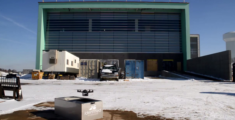
A company called Identified Technologies wants to make mapping a job site an easier task by using drones.
The company’s founder, Dick Zhang, says his product allows project managers, contractors, architects, and anyone else on the Building Team to send a quadcopter around the site and create a topographical map, DIY Drones reports.
The drone is completely autonomous, and batteries can be “hot-swapped” as it maps the area.
A number of contracts have already been made by several projects in Pennsylvania with Identified Technologies. “We have a heavy focus in the Marcellus Shale region, which delivers over 40% of this country’s natural gas. We’ve experienced consistent growth every month. We are forecasting 10-times growth in our deployments and revenue over the course of the year,” Zhang told DIY Drones.
Related Stories
BIM and Information Technology | Jul 29, 2015
Tenn. startup uses freeform 3D printer to build full-size walls
Branch Technology used the world’s largest freeform printer, one that has an arm that prints objects in open space, to make the lightweight yet incredibly sturdy lattice structures.
University Buildings | Jul 21, 2015
Maker spaces: Designing places to test, break, and rebuild
Gensler's Kenneth Fisher and Keller Roughton highlight recent maker space projects at MIT and the University of Nebraska that provide just the right mix of equipment, tools, spaces, and disciplines to spark innovation.
BIM and Information Technology | Jul 20, 2015
New stylus brings digital sketching to the next level
Without buttons, users can change the weight of the stylus’ stroke.
BIM and Information Technology | Jul 16, 2015
BIM for O+M: New app streamlines project documentation handover process
The Building Ops app enables owners to begin operations on the first day with a turnkey maintenance and asset management solution, according to its maker, Autodesk.
BIM and Information Technology | Jul 15, 2015
Google launches open-source beacon platform: Eddystone
Though beacons usually broadcast information publicly, Eddystone has the option to communicate privately as well, which greatly expands the applications for the technology.
BIM and Information Technology | Jul 14, 2015
New city-modeling software quantifies the movement of urban dwellers
UNA for Rhino 3D helps determine the impact that urban design can have on where pedestrians go.
BIM and Information Technology | Jul 14, 2015
Nation’s first 'drone park' breaks ground in North Dakota
This is one of six testing sites around the country that are developing flight standards and evaluating the utility of drones for different tasks.
BIM and Information Technology | Jul 6, 2015
BIM/VDC training is more than learning the features
Training can be a taxing experience for both the class and the instructor. CASE's Nathan Miller offers four ways to make training more relevant to practitioners.
BIM and Information Technology | Jul 6, 2015
Researchers increase GPS precision to centimeter-accurate
A new startup is working with Samsung to develop a snap-on accessory for centimeter-accurate global positioning.
BIM and Information Technology | Jul 6, 2015
New documentary shows Legos as touchstones of creativity
The film's narrator, actor Jason Bateman, says it’s a story “about a simple toy and how its unique properties ushered in a new era of creativity for a whole generation.”


