flexiblefullpage
billboard
interstitial1
catfish1
Currently Reading

New Autodesk software allows visualization of more realistic bridge concepts

New Autodesk software allows visualization of more realistic bridge concepts

This update to Autodesk BIM 360 improves integration with the cloud


By Autodesk | April 2, 2014
Autodesk has announced the Autodesk 2015 software portfolio of design, engineering, and construction solutions to help drive a global transformation to Building Information Modeling (BIM).  The 2015 Suites for buildings, civil infrastructure, and oil & gas projects offer hundreds of improvements and new capabilities for Autodesk Building Design Suite, Autodesk Infrastructure Design Suite  and Autodesk Plant Design Suite.  In addition to the Suites enhancements, the Autodesk InfraWorks 360 family of offerings now includes enhanced roads and highways capabilities and new features to help civil engineers to model and visualize more realistic bridge design concepts.
 
“The architects, engineers, and contractors who use our products told us that they needed solutions to meet their real-world challenges, and we are responding. The 2015 Suites meet requests for greater productivity, improved collaboration, and more complete, better integrated BIM workflows," said Amar Hanspal, senior vice president, IPG Product Group, Autodesk. “We also continue to offer more flexible ways to license our software, as well as more cloud services to improve customer collaboration and efficiency. Together with our customers, we are transforming the way buildings and infrastructure will be designed and built going forward.” 
 
Here are the new features available in all of the 2015 Design Suites:
 

Productivity and design improvements including:

  • An updated, modern interface for Autodesk AutoCAD 2015 and AutoCAD 2015-based products: Helps building designers and civil engineers quickly open new and existing drawings with New Tab, visually access drawing content with Ribbon Galleries, and easily find tool locations with new Help Window functionality
  • Integrated 2D & 3D quantification capabilities in Autodesk Navisworks Simulate 2015 and Autodesk Navisworks Manage 2015
  • Better integration with the cloud: New one-button access to Autodesk BIM 360 from Autodesk Navisworks Manage 2015, Autodesk Navisworks Simulate 2015, Autodesk Revit 2015, and Autodesk AutoCAD 2015 helps customers collaborate and manage their BIM project workflow and data
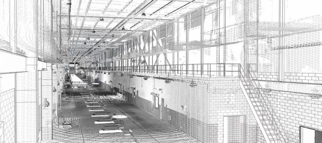
  • Enhanced point cloud capabilities include improved control over point cloud datasets and enhanced display settings in AutoCAD 2015-based products, as well as Autodesk Navisworks Manage 2015, Autodesk Navisworks Simulate 2015, Autodesk Revit 2015, Autodesk 3ds Max Design 2015, and Autodesk InfraWorks 2015, provide more realistic visualizations and walk-throughs
 

Building Design

 
Autodesk Revit 2015 software* offers customer requested improvements to help make it easier for architects, and engineers to:
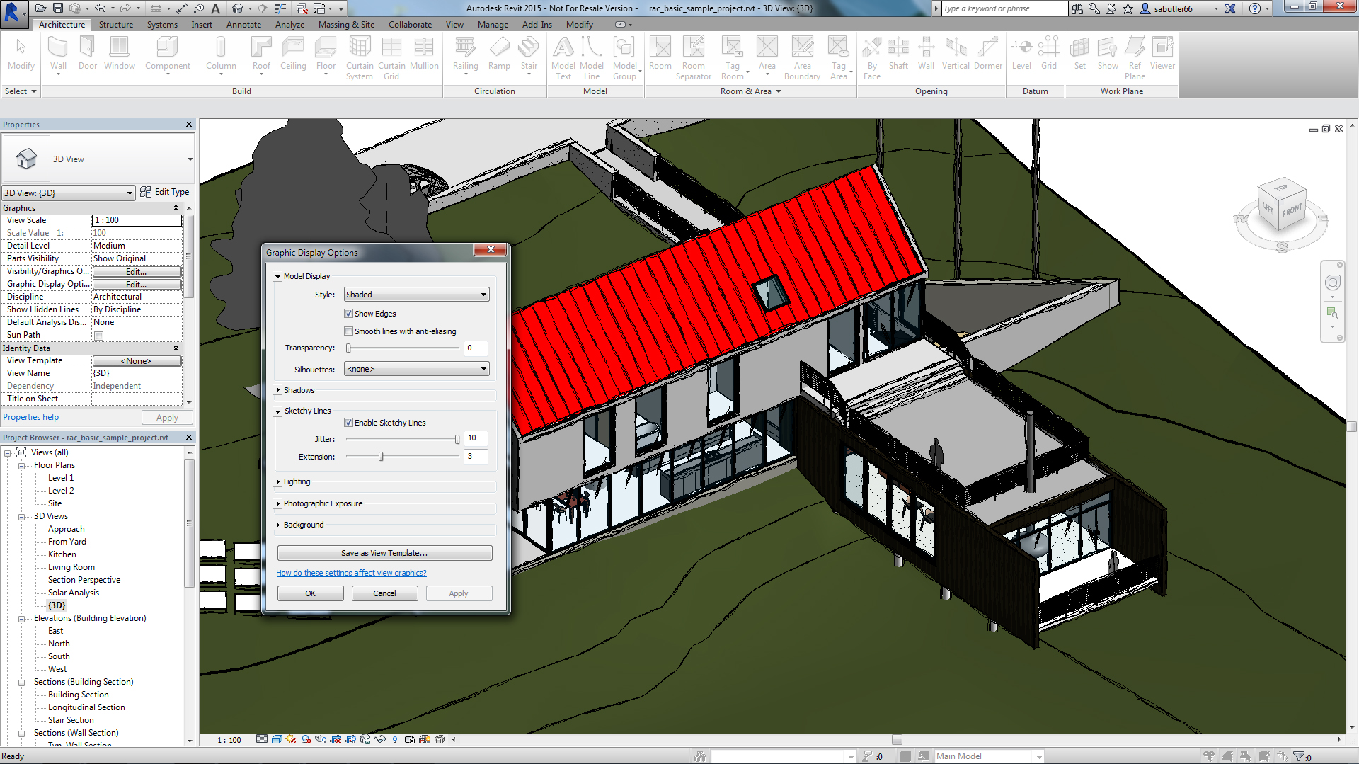
  • Apply a hand-sketched, graphic style to models, using the sketchy lines feature
  • Include imagery in schedules to better convey graphical information
  • Create and manage changes with improved tools to sketch and control revision cloud shapes  
  • Create more accurate documentation in 3D views using enhanced hidden lines capability
"As we've grown, we've committed more and more to Autodesk Building Design Suite because it gives us the complete digital toolbox we need not just to complete projects, but to innovate as well.  While Revit is our design workhorse, and we use Navisworks to coordinate building systems, we also use many other tools in the Suite as well as Autodesk 360 cloud services,” said Andrew Watkins, Associate Principal, Ayers Saint Gross, a top 300 global design firm according to ENR Magazine. 


Civil Engineering

 
Autodesk AutoCAD Civil 3-D 2015 software includes these improvements users have been asking us for:
  • Greater flexibility for designing and displaying corridor models
  • More efficient creation of profile layouts
  • Better production drafting to create deliverables more efficiently
  • More consistency between the AutoCAD Civil 3-D and AutoCAD ribbon/command set
  • Simpler ways to create custom subassemblies
  • Streamlined geographic location functionality includes ability to capture and embed Online Map Data (e.g. aerial map information) for offline viewing and plotting
  • Better interoperability and data exchange functionality for DWG and DGN files   
 
Autodesk InfraWorks 2015 (which is included in various editions of the Autodesk Infrastructure Design Suite 2015 and Ultimate edition of the Autodesk Building Design Suite 2015) and Autodesk InfraWorks 360 (which offers additional cloud services that add collaboration and analysis for large-scale preliminary designs) offer new features and capabilities including: An updated user interface for quicker access to the tool you need Support for additional data formats including AutoCAD 3D DWG, AutoCAD Civil 3D DWG, 3D DGN, IFC, and Sketchup (SKP) CityGML import now supports schema location, building asset mapping, and self-intersecting geometry 
 
Key updates for Roadway Design for InfraWorks 360 include style zones within road sections and fixed width parametric grading for roads with discrete control over grading, cut slope, and fill slope.
 
The new Bridge Design for InfraWorks 360 helps civil engineers explore preliminary bridge design options more effectively by modeling and visualizing realistic civil structures in the context of the surrounding proposed site. This new application helps simplify, accelerate, and focus the layout of girder bridge design concepts, and maintain consistent data and context.
 
Autodesk also released previews today for upcoming industry-specific applications for InfraWorks 360 including Drainage Design for InfraWorks 360 and cloud services including Model Builder for InfraWorks 360 and Corridor Optimization for InfraWorks 360.
 

Oil & Gas: Plant Design

 
Key customer requested enhancements to the Autodesk Plant Design Suite 2015 include:
  • Center of Gravity (COG) functionality to identify and edit COG for piping models, spools or components and produce COG reports
  • Fixed-length pipe modeling capability helps route fixed-length piping more easily
  • Bill of Materials capability to create tables and linked annotation when composing orthographic drawings
 

Availability

 
Autodesk Building Design Suite 2015, Autodesk Infrastructure Design Suite 2015, Autodesk Plant Design Suite 2015 and Autodesk InfraWorks 360 availability and related cloud services vary by country. Details and purchasing options are available at www.autodesk.com/purchaseoptions, with subscription options outlined at www.autodesk.com/subscription/overview.

Related Stories

BIM and Information Technology | Mar 13, 2017

Real-time, high-speed scanning – The latest in reality capture

Here are a few new reality capture products and platforms that caught our eye.

BIM and Information Technology | Mar 10, 2017

'Reality modeling' arrives

Advanced reality capture technologies are breaking down the barriers between the job site and project models.

BIM and Information Technology | Feb 6, 2017

BIM for O+M: Less about the model, more about the data

How one Building Team is giving a university client what its facilities staff really wants from BIM: information, please.

Codes and Standards | Jan 13, 2017

New BIM guide for owners released

National Institute of Building Sciences releases a manual for developing standard set of BIM documents.

Designers | Jan 13, 2017

The mind’s eye: Five thoughts on cognitive neuroscience and designing spaces

Measuring how the human mind responds to buildings could improve design.

Architects | Oct 11, 2016

A good imagination and a pile of junk: How maker culture is influencing the way AEC firms solve problems

“Fail” is no longer a dirty four-letter word: for maker culture, it has become a crucial stop along the way

Building Technology | Oct 7, 2016

How much is that LEED point worth? A new tool provides answers

Autocase analyzes the financial, social, and environmental benefits of certification.

Sponsored | BIM and Information Technology | Oct 3, 2016

A laser scanning solution for challenging topographic surveys

DeWalt Corporation, which has completed thousands of surveys over the last 50 years, began using 3D laser scanning technology nearly five years ago. 

BIM and Information Technology | Sep 15, 2016

8 tips for perfecting co-location

Experts share tips and tricks for maximizing cross-team collaboration.

boombox1
boombox2
native1

More In Category


Great Solutions

41 Great Solutions for architects, engineers, and contractors

AI ChatBots, ambient computing, floating MRIs, low-carbon cement, sunshine on demand, next-generation top-down construction. These and 35 other innovations make up our 2024 Great Solutions Report, which highlights fresh ideas and innovations from leading architecture, engineering, and construction firms.

halfpage1

Most Popular Content

  1. 2021 Giants 400 Report
  2. Top 150 Architecture Firms for 2019
  3. 13 projects that represent the future of affordable housing
  4. Sagrada Familia completion date pushed back due to coronavirus
  5. Top 160 Architecture Firms 2021